No risk of Cyclone 'Dana' entering Bangladesh: Meteorological Office
-
-
|


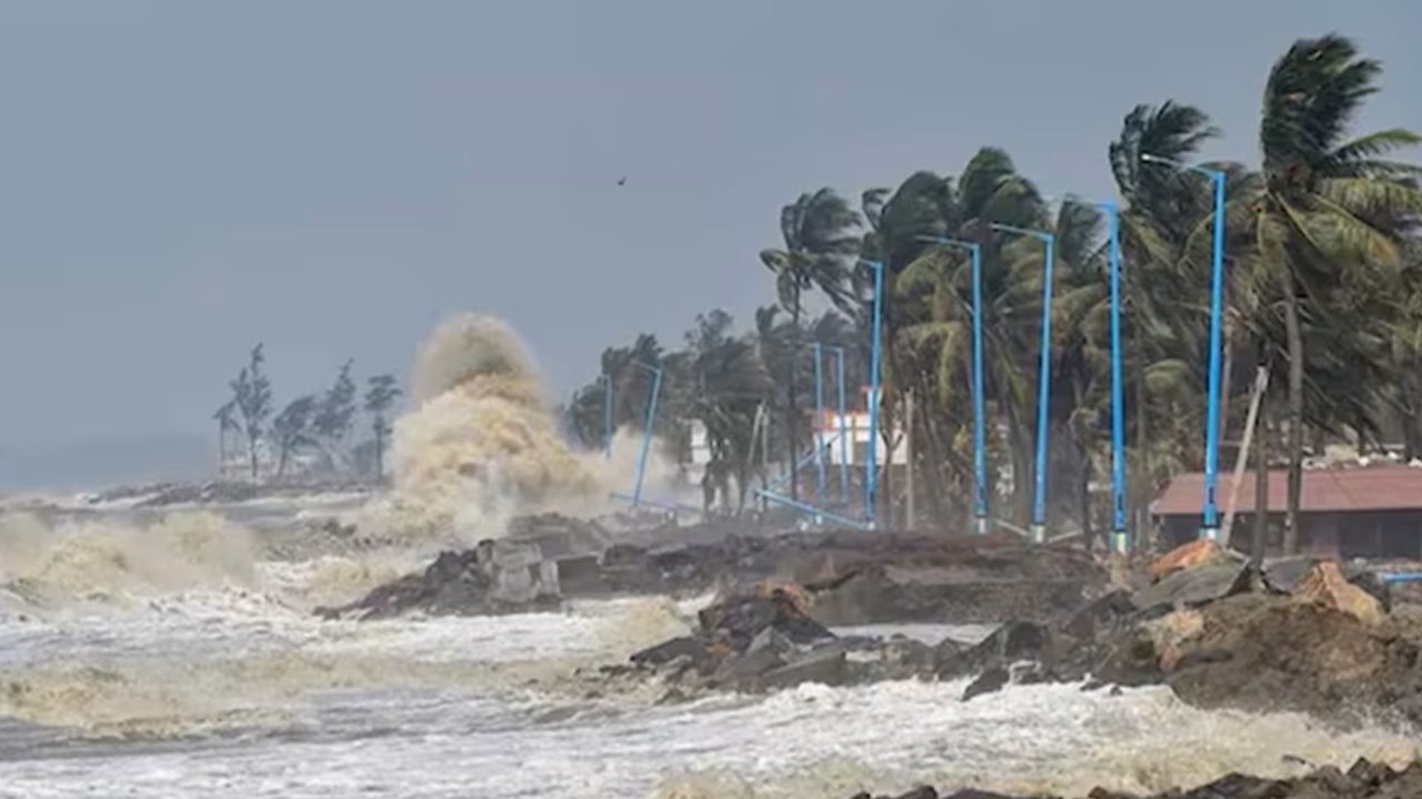
Photo: Barta24.com
There is no risk of Cyclone 'Dana' forming in the Bay of Bengal entering the plains of Bangladesh, said Meteorologist Dr. Md. Bazlur Rashid.
He told reporters this information on Thursday (October 24).
Bazlur Rashid said that Cyclone 'Dana' is currently located in the northwest Bay of Bengal and adjacent areas. It may move further north-northwest. There is no risk of it entering the plains of the country. However, due to its impact, stormy winds may blow in the coastal areas along with rain.
In this situation, all seaports in the country have been asked to display local warning signal number 03 (three).
Meanwhile, due to the influence of 'Dana', the tidal height is likely to increase in the coastal rivers of Satkhira, Khulna, Bagerhat, Barguna, Barishal, Jhalakathi, Pirojpur, Patuakhali, Bhola, Laxmipur, Noakhali, Feni, Chattogram and Cox's Bazar districts.
The Meteorological Office said that the severe cyclonic storm 'Dana', which is located in the west-central Bay of Bengal and the adjacent northwest Bay of Bengal area, has moved further north-northwestwards and is currently located in the northwest Bay of Bengal and adjacent areas. It was located 570 km southwest of Chattogram Seaport, 535 km southwest of Cox's Bazar Seaport, 435 km south-southwest of Mongla Seaport and 435 km south-southwest of Payra Seaport at 12 noon today. It is likely to move further north-northwestwards and cross the north Odisha-West Bengal coast of India between Puri and Sagar Island by midnight today.
The front of the severe cyclonic storm is likely to cause heavy (44-88 mm) to very heavy (≥ 89 mm) rainfall with gusty/squeezable winds over the north Bay of Bengal and adjacent coastal areas of Bangladesh and its offshore islands and chars.
The maximum sustained wind speed within 64 km of the centre of the severe cyclonic storm is 90 kmph, increasing to 110 kmph in gusty or squally winds. The sea is very rough in the area near the centre of the severe cyclonic storm.